The Renkums Beekdal, located on the edge of the Veluwe in the Netherlands, is an ecologically and hydrologically very interesting stream valley. The area is also challenging due to the very complex soil structure with many different soil layers. In order to understand how the water system in the stream valley works, the 'Vallei en Veluwe' Water Board had a sustainable flow measuring point set up by Royal Eijkelkamp.
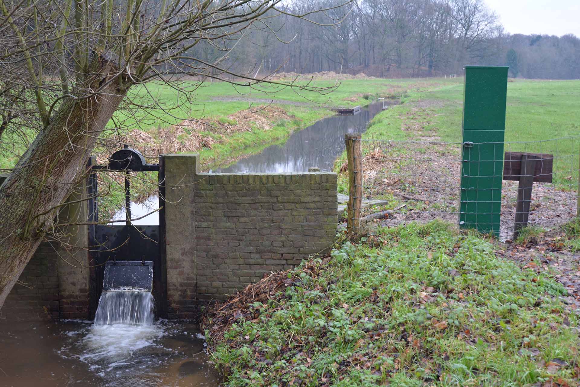
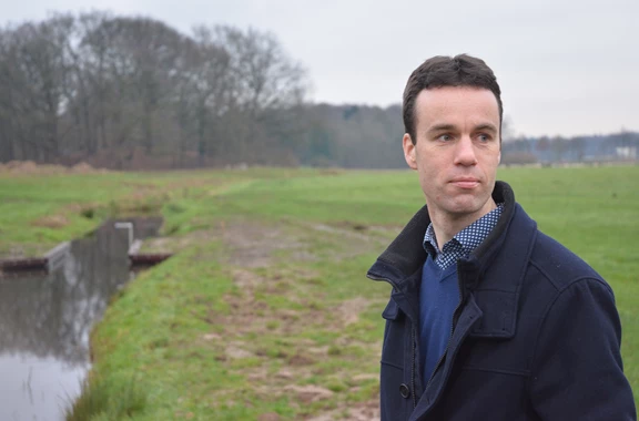
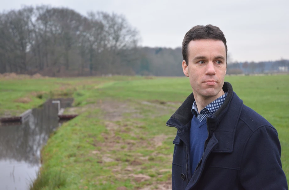
Marinus van Dijk, who works for the Water Board in the Planning Department, talks about the Renkums Beekdal with great passion: 'It is a beautiful stream valley with a lot of difference in height. The water comes from the Veluwe and slopes steeply towards the Rhine with a lot of seepage, streams and cultural history. In the past, the watermills were powered by the streams. They are mostly trained streams that are sometimes stunted to retain water. This is a really nice system that used to give a lot of water. Back then, the groundwater levels were generally a bit higher and there were hardly any groundwater abstractions.'
'Meanwhile, the groundwater situation in the Veluwe has changed. For example, intensive grazing has made the soil bare, causing rainwater to sink directly into the soil. In addition, a lot of coniferous wood has been placed. This has the characteristic that it evaporates a lot of water. After more than 100 years, it can be noticed that that enormous groundwater bubble under the Veluwe is sinking. Finally, there are several drinking water abstractions in the area. These also have an effect on the groundwater system.'
'Nowadays we are dealing with less and irregular water. In the summer we often have to deal with stagnant water or even drought. That is why we are now carrying out repair work together with the Province of Gelderland and water company Vitens to make the water system more robust, to make better use of the available water and to allow the ecology to flourish.'
'The Renkums Beekdal does not make it easy for us. From a hydrological point of view, it is a difficult area to interpret. The entire Veluwe is of course a large moraine where all soil layers are skewed with clay, loam, sand and gravel. That is almost impossible to map and model. You can of course do a lot of deep drilling, but that also comes with a hefty price tag. We did set up a monitoring network years ago. At that time, the measuring equipment was fine and the data were of very high quality. However, in hindsight it was not a good setup, because we could hardly ever measure. That's when we decided to remove the measurement locations and set up something new.'
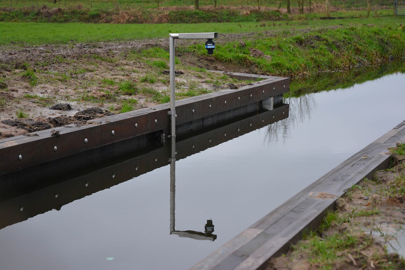
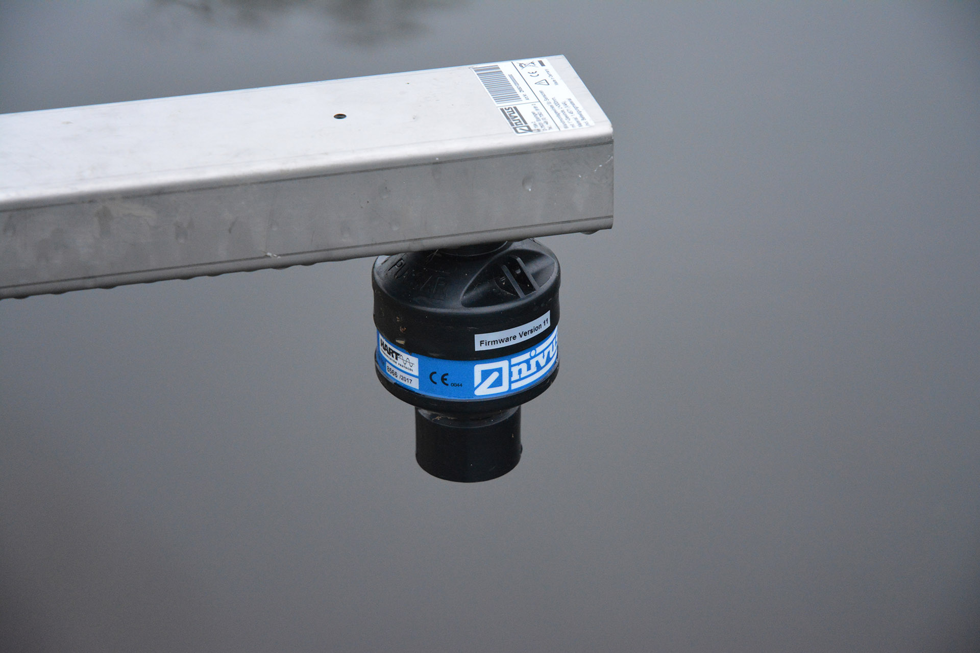
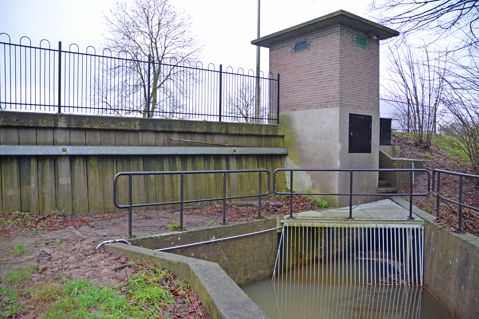
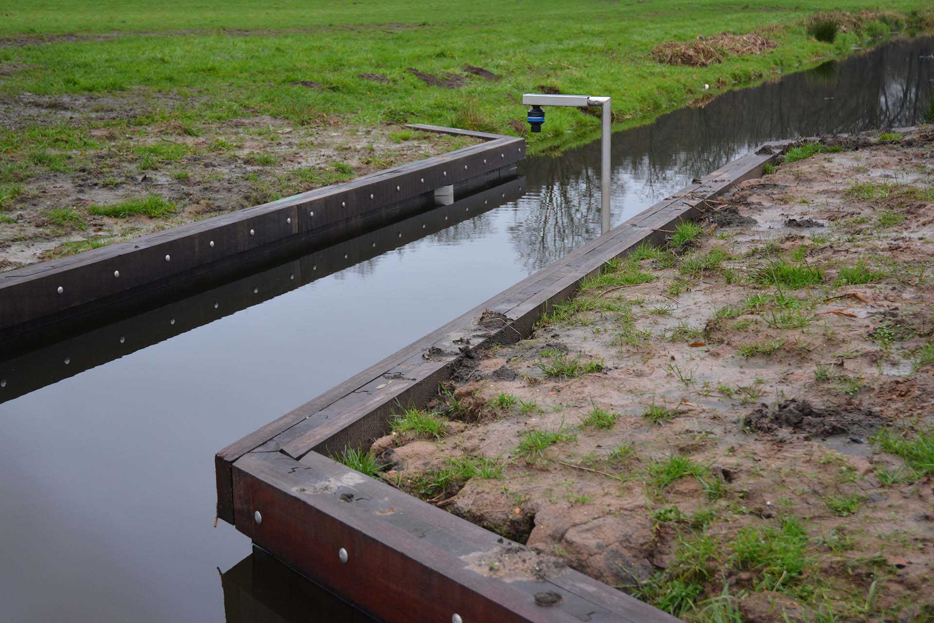
'We have made one flume at the end of the stream valley that always works well, with high and low discharge, that does not build up too much, and is fish passable. It has become a sturdy and beautiful measuring point that we can use for years to come. It is not susceptible to clogging and vegetation. The bottom of the flume is concrete and is two meters wide. The vertical walls of the flume are made of wood and are one meter high. Four Transit Time sensors from NIVUS have been installed on the vertical walls. These sensors alternately transmit and receive high-frequency ultrasonic signals. The difference in time (Delta T), which is on the one hand caused by measuring against the current and on the other hand with the flow, is correlated with the flow rate of the entire water volume. An I-sensor has also been installed to measure the water level without contact, so that the wet surface can be calculated.'
'Of course we hope that, over time, we see something of the measures we are taking now via this measuring point. It is not a measuring point that we want data from every minute. We now get data four times a day and that's fine. It's been measuring really well for a few weeks now. In December we also measured the high discharges with a lot of precipitation. It shows a nice drainage pattern and no hitches, so it's perfect.'
Need advice choosing the right product for your application? Our specialist Sandra is happy to help.